


MOUNTAINS LAKE, OREGON

Mountains Lake Circuit - Part 2
 00 miles: As you leave Howard Prairie marina entrance, turn left
I've re-set the mileage assuming you have added some distance getting to marina and in the parking lot. We certainly did, moving the car to get into shade, etc. in late spring some of these mountain openings can be alive with feeding birds as the snow melts here before it does in the shadier woods.
01.1 mile: Intersection
Road to Howard Prairie Dam goes left. Road to Hyatt Lake goes right. If you visit the dam, you've good chance of more views of eagle and Osprey on the large open end of the reservoir. Keeping right you soon we pass a 5 mile marker, probably distance from Dead Indian Memorial Road.
 03.7 miles: On the left you can turn onto East Hyatt Lake Road
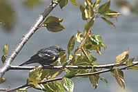
That road goes along other meadows where Great Gray Owl apparently occur. There are pull-offs all along the road now. Habitat is evergreen forest, with occasional meadows. Robin, Townsend's and Yellow-rumped Warbler, Chipping Sparrow, Northern Flicker. The Yellow-rumps love a good pish so give 'em a go. This has never proven to be a good birding road, however.
03.8 miles: Buck’s Divide Road heads west through tall timber.
Now the corner of Hyatt Lake is on your left. A rough dirt road runs along the lake shore, or you can stick to the paved highway. There are many convenient pull-outs. Watch for Bald Eagle which are often seen passing overhead to and fro as they fish this lake.
 04 miles: Table Mountain Road, unpaved, goes off to the right
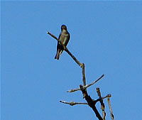
Canada Geese, Double-crested Cormorant, Robin, Junco, Olive-sided Flycatcher, Dusky and Willow Flycatchers. For Hammond's you'll need to leave your car and get into the woods. In spring White-crowned and Golden-crowned Sparrows. Evenings in the woods here could let you hear forest owls, including Great Gray.
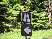 05 miles: Pull-off marked by binoculars sign
There is a pair of Williamson’s Sapsuckers nesting near here each spring. This spot is only a couple dozen miles from where the first Williamson’s Sapsucker was collected for science by soldiers conducting a U.S. Railroad survey commanded by Lt. Williamson. That was in 1854.
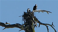
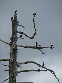 This pull-out has a toilet and small paved parking area. Double-crested Cormorants nest in tall dead tree about fifty feet offshore, depending on lake level. You will hear them grunt and short. North along the shore you should see large stick nest of Osprey on a tall snag. They begin nesting before Hyatt Lake is thawed some years. This lake is over 5,000 feet in elevation and thaws later than Howard Prairie. I have seen this lake frozen and snow-covered with hundreds of Tree Swallows fly- catching just above the drifts in early April.
 At this pull-out you can expect Robin, Brewer's Blackbird, Yellow- rumped Warbler even on a cold spring day. I’ve seen them chasing insects across snow that is defying the spring sunshine. Spotted Sandpiper nest along the shoreline. Raven, Red-tailed Hawk, Mountain Chickadee, Flicker, Olive-sided Flycatcher, Junco, Red-breasted Nuthatch.
06 miles: Left hand dirt road to Hyatt Lake Resort & dam site
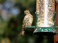 The surface of Hyatt Lake averages an elevation of 5,015 feet above sea level. Primitive store here, cabins without kitchens, good views of dam area from large dirt parking lot. There is a feeder on a home at the far end of the parking lot. Expect Siskins and Purple Finches there. Here we took East Hyatt Road which leads downhill toward State Route 66. In open areas the curious Golden-mantled Ground Squirrel may follow your movements.
07 miles: Mountain stream crosses under road
There are numerous gravel roads leading off into deep evergreen forest here. Still wanting to track woodpeckers and Hammond's Flycatcher, this is good place to try as dense forest stretches over next few miles. We found butterflies thick along the road edge here.
 10 miles: Intersection with STOP sign
This is Oregon Route 66. Sign says: Ashland 18 (to the west or right), Klamath Falls 45 (to the east or left). At this intersection is the Green Springs Inn and the Cascade Siskiyou National Monument Information office which appears to be about six foot square. Now the road begins to descend and follows a small creek. Turn right toward Ashland. Klamath Falls needs at least a full day for birding.
 11 miles: Small reservoir created by dam across Keene Creek
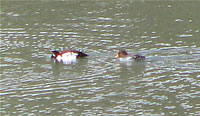
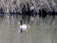
Stop at uphill end of reservoir where the road has curved bridge over Keene Creek. The old road bridge is still there on the right. It affords good spot to bird the mountain stream and its flanking trees. We were here in the heat of mid-day so bird activity was diminished. In this small reservoir I've seen Lesser Scaup, Bufflehead, both Goldeneyes, Coots. There is little shoreline vegetation so diving ducks feel most at home here.
 12 miles: Green Mountain Summit, 4,551 feet elevation
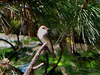
You'll begin to get your first looks at 7,500-foot Mount Ashland to the west. Soon you also see Pilot Rock to the southwest, a round rock standing above the surrounding ridges. Here the forest becomes dominated by oaks as the elevation drops and the heat increases. During the descent any amateur geologists will be noticing the bare volcanic rocks and the ways in which they cooled or were extruded in this area with a long, eruptive history. The views here along Route 66 are the most extensive of the trip. Camera time. Western Wood-Pewee, Rufous Hummingbird. Tyler Creek Road, just beyond the summit. It heads south and then west. Down this road are private farms, creek and ponds habitat, rich birding in spring when you can find warblers, Warbling and Cassin’s Vireos and small flycatchers returning north. Tyler Creek Road drops steeply down to Buckhorn Springs Road, where you can turn right to get back to Highway 66.
14 miles: Pull off on left hand side
Vertiginous cliff offers view over the 1,000 foot deep gorge holding Schoolhouse Creek. Here the volcanic rocks are crystallized in hexagonal tubes, side-by-side like shitake mushrooms. Here also I watched two juvenile Goshawk working hundreds of feet over the trees at the bottom of the gorge. Their fluffy white undertail coverts gave them the apparent tail pattern of Junco. Field guides are not terribly helpful with this look--you're not supposed to be looking down onto a Goshawk, right?
 17 miles: Watch for milepost 10 on Highway 66, it's at a large dirt pull-out on the east side of the road and there's a large farm gate and tall utility polls in the field to the west
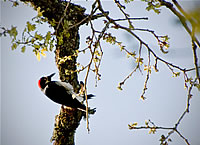
Oaks here shelter Lewis's Woodpeckers in winter, they may linger until mid-May. Also about: Lesser Goldfinch, Acorn Woodpeckers (resident), Western Bluebird, Chipping Sparrow, Western Meadowlark, Kestrel. Look back uphill for possible glimpse of Golden Eagle. This dry western sloping terrain is also the area where you're most likely to see Black-billed Magpie in Jackson County. In winter I found Goshawk hunting over the oaks right along the road. As you move down into oak-studded grasslands, you have re-entered the territory of Western Scrub-jay, Americans Crows, Oak Titmouse, Ash-throated Flycatcher and the usual riparian species along the creeks.
19 miles: If you continue on Highway 66 it takes you alongside the western shore of Emigrant Lake and back toward Ashland and I-5's Exit 14
Buckhorn Road on the left, along with Buckhorn Creek. If you turn left and go up this road, some rich birding habitat awaits you. Scrub on the hilltops have Blue-gray Gnatcatcher, an uncommon species in this area. Also these forests have Nashville Warblers, woodpeckers, Oak Titmouse. A pair of Dippers usually nest at the first bridge where the new bridge parallels a rotting, abandoned wooden one.
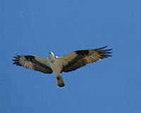 Buckhorn Creek flows into upper end of Emigrant Lake. Rich riparian habitat here. And you are now in the Emigrant Lake area. There are Red- shouldered Hawks and White-tailed Kites breeding at this end of Emigrant. Osprey, Bald Eagles, Golden Eagles, Clark’s Grebes, Oak Titmouse, Black-capped Chickadee, Flicker, Acorn Woodpecker, Downy, California Quail, Common Merganser, Western Bluebirds, Wood-Pewee, Ash-throated Flycatcher, Ravens -- all can be found around this lake. Golden- crowned Sparrows are dense in winter, combined with a few Fox, White- crowned, local Song and occasional Lincoln’s. Spotted Towhee common. California present but scarce. Tundra Swans and Pipits may stop in the fall. I’ve seen Sandhill Cranes flying north on the last day of February, southward in late fall.
Intersection of old Siskiyou Highway and Highway 66. You’re about 4.5 miles from the start of Dead Indian Memorial Road. Just follow Route 66 on north into Ashland (back to I-5 Exit 14). If you turn left (south) on Old Siskiyou Highway you will wind along the steep and switchback route of old Highway 99. Just south of the switchback where the road literally circles over itself as it gains altitude is apparently the best place in Jackson County to look for Evening Grosbeak in May. I have seen them here myself. "Oh sure," say the veteran birders here. They expect the Evies in this area. This road eventually takes you past the turn-off to Mount Ashland (next to the last I-5 interchange inside Oregon) and then on to the base of Pilot Rock.
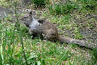
One mammal you're likely to spot on this circuit is the California Ground Squirrel.
Back to Part 1 if you wish. See also Willow Witt Ranch Bird List.
TOWHEE.NET: Harry Fuller, 820 NW 19th Street, McMinnville, OR 97128
website@towhee.net