


SAN FRANCISCO TO OREGON
Birding: SF to Oregon
This is meant to be a handy roadside birding guide for birders driving north from the Bay Area to the Northwest. If your destination is Ashland, Medford, Eugene, Corvallis, Portland or the Seattle area, you will likely be heading up I-5 (so see also our page on Oregon I-5 Birding). This specific itinerary begins at the toll plaza at the south end of the Golden Gate Bridge. If you're from the East Bay your route would intersect this itinerary somewhere in Solano County, either at Vallejo or east along I-80.
Anybody encountering interesting birds along this route that are NOT mentioned in this commentary is urged to email this website at towhee@gmail.com. County names in [name] for county listers.
Golden Gate Bridge Toll Plaza: 00 mileage.
You're on Highway 101 heading north. At any season Western Gulls soar through the gentle concave curves of the Golden Gate Bridge's suspension cables. You can see them if the fog is not too think. Fog season really picks up as the temperatures begin to rise over inland California in April. By July fog is regular and often dense. The Western Gull is the only species of its family that nests annually in large numbers around San Francisco Bay and on offshore islands.
Driving across the bridge you'll see Brown Pelicans from April through December. In the winter months an occasional Glaucous-winged Gull passes over the bridge as well. Cormorants fly low so for those you'll have to get out and park your car. [San Francisco]
If you do park your car for some birding before you get onto the Bridge, you have choices.
In the autumn, go to the top of the old cement gun emplacements west of the toll plaza. This is Battery Gottfried. From here you can look for raptors and other migrants coming south across the waters of the Golden Gate at its narrowest point. Golden Gate Raptor Observatory does an annual count from the local hawk hill just opposite on the Marin Headlands. Here are some recent count results: http://www.ggro.org/research.html
From a vantage point east of the Bridge you may see any of the three local cormorants: Brandt, Pelagic or Double-crested. From October through March scan the waters east of the bridge for the seasonal flock of grebe, mostly Western with some Clark's and occasionally a Red-necked or two. Wintering Common Loons are possible but they tend to like calmer waters east of the turbulent area around Fort Point at the south end of the Bridge. Forster's Terns and especially Caspian Terns can be seen from here in summer. In late summer and fall the Elegant Tern is possible after they migrate NORTH following breeding season in southern California. [San Francisco]
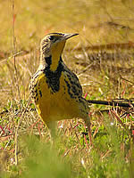
From the toll plaza it's a short walk in the Presidio to the Kobbe & Upton intersection that appears misleadingly ordinary. Here the first recent record of Steller's Jay in San Francisco was recorded in the 1990s. That jay and the Western Scrub-jay both nest near here. Hooded Orioles annually nest in or near the two tall fan palms at this location. This area is a good bet for Olive-sided Flycatcher from April through August. The male calls from atop a tall evergreen. This bird is diminishing due to loss of winter habitat in the tropics. You may find Red-tailed Hawks, Great Horned Owls and wintering Red-breasted Sapsuckers who like the small trees planted here. Black Phoebes, Bushtit and other insect-eaters are regular. Western meadowlarks often found during winter in the grassy field east of Kobbe & Upton. [San Francisco]
Marin Headlands 2 miles from toll plaza [Marin]
Almost as soon as you get off the Golden Gate Bridge you begin to see Turkey Vultures, perhaps Red-tailed Hawks or Ravens. If you drive far along the route of this itinerary you will see many Turkey Vultures ("TV") and they are perhaps the most widespread bird of this trip.
Richardson Bay 5 miles from toll plaza [Marin]
Here you're down to sea level, having driven around picturesque Sausalito. Along the bay's shore here you may see Snowy or Great Egret. In the winter Greater Scaup or Surf Scoter can loiter here.
If you drive onto Highway One, the exit just before the Richardson Bay Bridge, you can get into a small saltwater marsh. Enter the parking lot of the Holiday Inn on your right (east) of the highway. Drive to the very back of the lot and walk onto the trail that runs past the motel. You'll see a wooden pedestrian bridge crossing Tennessee Valley Creek, leading to marsh beyond. In winter it's a good spot for Short-billed Dowitcher, Western Sandpiper, Long-billed Curlew and other mud-loving shorebirds. Clapper Rail occasionally appear here. In the shallow estuary there can be wintering ducks in season, Forster Terns in summer, gulls any time. As you move away from the Pacific, American Crows will displace Ravens.
Paradise Drive, Corte Madera 8 miles [Marin]
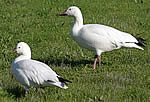
 You can exit US 101 here for another handy salt marsh. Go east until you can turn onto the northbound frontage road that goes past the shopping center east of 101. Just after the frontage road turns to parallel US 101 on the left, there's a marsh on the right and a tiny parking lot. It has been appropriately named "Shoebird Marsh." It offers a vantage point for scoping the birds. Several duck species winter here including Wigeon, and Green-winged teal. Gadwall, Mallard and Canada Geese breed here. There've been Hooded Merganser here some winters. Stilts and Avocet are year-round. Wintering birds include Black-bellied Plover. Marbled Godwit and Willet. American White Pelicans visit during fall and winter as do gulls and terns. Scan the trees beyond the marsh for possible White-tailed Kite.
Len Blumin finds a great spot for a quick fix of birding, "It is very reliable in winter for Canvasback and Ruddy Duck... Also a good place for Semi-palmated Plover. I like to tell people it is a good spot to get 30 species in 10-15 minutes."
Marin Civic Center, San Rafael 15 miles [Marin]
On the right side as you head north. Designed by Frank Lloyd Wright. Architecture, not ornithology here. There a small lake north of the Civic Center with hiking trails, picnic tables and little to offer for birders except close-hand study of American Cot behavior.
Smith Ranch Road, north San Rafael 16 miles [Marin]
Exit 101 here for some fine sewer pond and grassland birding. Go right (east) on Smith Ranch Road, past modern sprawl, cross ancient railroad tracks at entrance to county park. Here take left hand turn onto narrow road (not entering the park), pass the soccer field on your right, follow this road past an odd collection of buildings on the left that was once a prison, still behind high wire fence.
When you approach the entrance to the sewage treatment plant, take the road on left that is outside the security fence. About one hundred yards past sewage plant entrance is small parking lot and toilet kiosk. Here's where your car belongs. Walk out around the ponds. Myriad wintering ducks are annual, especially Bufflehead and Ruddy Ducks. Stilt and Cinnamon Teal breed here. Migrating shorebirds stop here often in the fall, including windblown phalarope who should be at sea.
I got my lifer Pectoral Sandpiper here one fall. This is good spot to find all your western herons and egrets including the locally uncommon Green Heron. Lesser Goldfinch, Black Phoebe, Song Sparrow, Marsh Wren, wintering Say's Phoebe, Peregrine, even Golden Eagle are possible landbirds.
The dense biomass in summer attracts swallows, and other western species may occur among seemingly infinite Cliff Swallows. Arlene Gemmill, "I would add that the Los Gallinas Sewage Ponds often has White Pelican, plus Short Eared Owl, Red Necked Phalarope, Harrier and Peregrine." Phalarope only during migration.
Exit US 101, turn east on Cal 37 20 miles [Marin]
 The flatlands here were once salt marsh. Much of the land now has been converted to pasture or even housing. But on the left is some restored marsh and you may see Canada Geese grazing among the cattle. Watch the fence posts for Brewer's and Red-winged Blackbirds, possible Beechey's Ground Squirrels. North of the road is a marsh. Canada Geese abound. In the dry fields Red-winged blackbirds, Western Meadowlark, American Goldfinch, House Finch and swallows (summer) can be found.
Grasslands 21 miles [Marin]
Despite heavy traffic noise you may hear singing Western Meadowlarks. Early in the morning, large honking mobs of Canada Geese may fly over en route from the marsh to their favorite grazing spots. Barn Swallow, Double-crested Cormorant passing, House Finch, American Goldfinch, Bushtit, Brewer's Blackbird, Red-winged Blackbird, White-crowned Sparrow. In sewer ponds on the left watch for Snowy and Great Egrets on the embankment. Black-tailed Jack rabbits also possible here.
Petaluma River 24 miles [entering Sonoma County]
This tidal estuary bridge affords good views up and down the river. Forster's Tern, gulls and egrets are all I've seen in dozens of crossings. Beyond this bridge you enter a stretch of over 12 miles of narrow, flat, two-lane highway with enticing birding spots all around. Highway 37 is heavily travelled by drivers in a hurry, so don't dawdle or gawk. Pull off at the occasional parking areas to look The first four miles of this flatland is mostly dry pastures and then some vineyards. Turkey Vultures and Red-tailed Hawks expected here.
Sears Point, Cal 121 heads north from Cal 37 28 miles [Sonoma]
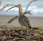
Keep on 37 through this intersection. That's a large auto raceway on the left, Sear's Point (Infineon Raceway). From the next ten miles the proportion of water to dry land changes. The first large impoundments are on your right. Ruddy Ducks, American Coots, Pied-billed Grebes are regular. Clark's Grebe a likely summer breeder. Worth a scan for other birds in winter. You can hike some dikes that lace these lowlands. I got my lifer Blue Grosbeak in the brush here many summers ago, a bird rare this close to the Pacific Ocean.
Just beyond the intersection watch for a parking lot on the right (south side) of the highway. Doug Shaw describes this spot, "the Tubb's Island parking lot along Hwy. 37 ... is about 1/4 east of the Hwy. 37/121 intersection. The pond at the parking lot is good for grebes, ducks, shorebirds, and terns. There is a trail/service road that leads all the way out to Tubb's Island/San Pablo Bay. The walk is quite long (around 10 miles round trip) and is great for waterfowl in the winter, but gets very muddy."
Tubbs Island parking area has no shade, no toilets.
Savannah Sparrow, egrets and herons, blackbirds, Canvasback, Lesser Scaup and Ruddy Duck wintering.
"Fresh Air" Janson Bridge & Vista point 29 miles [entering Solano on east]
 There are small parking lots and viewing platforms available for traffic in either direction. The one on north for westbound is better, showing both marsh and estuary. South of the road is national wildlife refuge land and you can see estuary meeting the Bay. Here you may find: Killdeer, Red-tailed Hawks, White-tailed Kite (far back from highway), Starlings, American Goldfinch, House Finch, Black Phoebe, Barn and Cliff Swallows, herons and egrets. On north side shorebirds will include resident Stilts and Avocets, wintering Marbled Godwit, Long-billed Curlew, Western Sandpiper. The flocks may run into the thousands of birds. Migratory shorebirds arrive in early July, leave by April.
Marshes along north edge of San Pablo Bay, Cal 37 30 miles [Solano]
 As the marsh becomes denser and fills both sides of the road: Black-necked Stilt, American Avocet, Black-crowned Night-heron, Snowy Egret, Great Egret, Pied-billed grebe, American Avocet, Black-necked Stilt, Forster's Terns, American Coot, Gadwall and other mud lovers. By July and through the winter they're joined by shorebirds including Short-billed Dowitcher, Long-billed Curlew, Western Sandpipers and huge numbers of Willet. There is some evidence this location may be a southern stop for many migrating curlew in late summer, a staging area before they disperse to their normal wintering grounds. In the larger water bodies north of 37, White Pelicans are dependable from July through January. All these birds can appear in various pools or marshes until you reach Vallejo's suburban sprawl. Land birds here can include the goldfinches, Red-winged Blackbirds, Song Sparrow, White-tailed Kite, Red-tailed Hawk and Northern Harrier. Len Blumin reminds me it's also good in late afternoon for Short-eared Owl. For much of this trip each bridge or man-made road structure is home to a colony of Cliff Swallows, so expect both Cliff and Barn Swallows in this area and all the way north to Mount Shasta.
Skagg's Island Road 32 miles [Solano]
Almost unmarked this little, disintegrating paved highway once led to Skagg's Island military base, now abandoned and the area is closed to the public. However, this short stretch of open road going north from Highway 37 allows you to get away from the traffic noise, walk a quiet paved road and bird marshes on both sides. The road has a raised bridge that gives a vantage point and there's free and unlimited parking. Since the base closed nobody uses this road except you and me. In early summer there should be juvenile Stilt and Avocet. In fall and winter these salt flats and ponds will be teeming with shorebirds and ducks. Often there are gray dunes of Willets blown into one corner of a pond, then elsewhere a slow-moving white drift of Avocet, or a heavy flotilla of white sailboats that are actually Pelicans, rusty rafts of Shovelers and far from the road a brown puddle of S-b Dowitcher. A great spot to bird by color.
Napa Sonoma Marshes 34 miles [Solano]
There are two pull-offs, accessible only from the westbound land. The most easterly has a sign saying "Napa Sonoma Marshes State Wildlife Refuge." It also attributes some of the land purchases here to the Shell Oil Spill Litigation Settlement. There is a large impoundment west of a dirt road with pedestrian access. This road heads north into the marsh.
Shorebirds, ducks, herons and egrets, terns & gulls, White Pelicans in season.
Napa River Bridge across broad estuary 37 miles [Solano]
Here as the Napa River meets the Bay is a broad, windy estuary. The bridge gives good views but there is no way for pedestrian access. There is a ground level viewing platform (vista) which can be reached from either direction of Highway 37. The old Mare Island nuclear sub base is on the south side just east of this bridge. At night you may imagine a soft radioactive glow. Mockingbird, Song Sparrows, herons and egrets, possible Caspian or Forster's Tern, gulls, ducks in winter.
Crossing the bridge you enter Vallejo but there's one last large, interesting saltwater impoundment on your right (east of 37). This can have White Pelicans, Common Goldeneye, Bufflehead and other wintering birds in season. I have not found safe parking along this busy highway for viewing, but surely in the nearby neighborhoods there would be some place to park and look if you choose to.
Marsh ends, Vallejo surrounds you 39 miles [Solano]
Here follow the signs that take you past Marineworld amusement park and thence onto I-80 heading toward Sacramento.
I-80, eastbound 42 miles [Solan-Napa-Solano]
The freeway quickly takes you away from Vallejo into dry, oak grassland. About a mile north of where you join the freeway you will cross a corner of Napa County which ends just north of the American Canyon Road exit. You may only see Turkey Vulture and American Crow from the car. You can be assured the oaks harbor Western Scrub-jay, White-breasted Nuthatch, Oak Titmouse and Bushtit. In summer the grassy hills turn a soft brown. My wife says "camel hair" while I prefer "natural suede." The hills do look like somebody's carefully upholstered them in a soft, dun material. If you are southbound on I-80 here there's an overlook just north of I-80 and Highway 37 intersection. Good picnic facilities if you like dining to freeway noise.
Toilets. Also decent place for birds: House Finch, Lesser Goldfinch, American Goldfinch, Western Kingbird, swallows, Scrub-jay, Mockingbird, House Sparrows.
Fairfield city limits, 46 miles [Solano]
Fairfield-Vacaville, I-80 48 miles [Solano]
At about this point you begin the slog through dense exurbia, people, cement, cars, eyesores on all sides. TV, Starlings and Crows abound, anything else will be hard to find unless you cruise the leafy neighborhoods for Mockingbird or Scrub-jay.
Budweiser factory 51 miles
Some of the world's worst pretend-beer comes from this big plant. Wait'll they start making it in China.
If you were to take Highway 12 east you'd be heading through Rio Vista to Lodi, home of the Sandhill Crane Festival each November. North of Lodi is the Cosumnes Nature Conservancy site which is rich in wintering waterfowl and shorebirds each year.
Coastal hills 58 miles [Solano]
Here are some partially preserved oak grasslands, rolling over steep but rounded hills. This is what much of inland coastal hills were like before houses, highways and agriculture. In late spring blooming plants along the median strip are oleander. You won't find them without leaving the freeway but this habitat should have Nuttall's Woodpecker, Oak Titmouse, Acorn Woodpecker, Western Scrub-jay, Chipping Sparrow, Lark Sparrow and various swallows in summer. Should you perish along the road, Turkey Vultures are readily available for clean-up.
Western Vacaville city limits 59 miles
Pena Adobe Road 60 miles
Exit here for Valley Lagoon Park which has fresh water lake and oak woodlands. This should be place for Bullock's Oriole, Western Kingbird, various swallows and Ash-throated Flycatcher. I have never stopped this early in my northbound trip, or so near to San Francisco, so I await somebody else's information.
Leave I-80 to take I-505 north 64 miles [Solano]
You soon leave behind the industrial parks, shopping malls, and housing sprawl of the I-80 corridor. This is classic California ranchland, the native grasses long ago replaced by exotics. All these eucalyptus trees are native to Australia. Watch overhead for raptors in the warm months.
Dry grasslands 67 mi [Solano]
You're now driving through over 30 miles of ranchland and farm land. Sparse population and sparse water as well. In this area Mountain Plover sometimes overwinter in the short grass or plowed fields. Where there's natural or irrigation water, birds can abound. One rice field here contained dozens of egrets and herons on a hot June day. Kestrel are possible here. Corvids rule: Western Scrub-jay, American Crow and this is best chance for Yellow-billed Magpie on this route. Expect Starlings, Brewer's Blackbirds and Mourning Doves as well. Swallows are likely to be Barn, Cliff or Northern Rough-wing.
Large plant nursery 73 mi
This large commercial nursery is the beginning of the Putah Creek flood plain and the best area to look for YB Magpie.
Putah Creek 75 mi [Solano-Yolo, north of the creek]
There is an exit from freeway just before you reach the creek. This riparian strip is good place to look for Magpie, Nuttall's Woodpecker, Hutton's and Warbling Vireo, Bullock's Oriole , Yellow Warbler, Black-headed Grosbeak. East of the freeway you can park next to the walnut orchards that front the creek.
In the winter the fields and orchards along this creek often attract rarities, esp. raptors and even Snowy Owl or Northern Shrike when they push this far south. If you follow Putah Creek west into the hills you can find habitat for Pacific-slope Flycatcher, Common Poorwill, Sage Sparrow, Lawrence's Goldfinch, White-throated Swift and other California specialties. If you have a target bird it is best to get local information on recent sightings. This is also good spot for butterfly chasing, and around Labor Day you can encounter a blizzard of cabbage whites floating across the land.
Mountains visible to the left of freeway 79 miles [Yolo]
 That is Rocky Ridge on the south, Blue Ridge on the north. They run along the east side of Lake Berryessa. This reservoir is now one source of Putah Creek's water. Fields here can render some common local birds like Killdeer, Mourning Dove and Great Egret.
Cache Creek, gravel works, south of lane with valley oaks 87 miles [Yolo]
This short line of graceful, droop-limbed valley oaks give a hint of what this area was like before wheat farming was followed by intensive ranching and then irrigation cropping for rice or sunflowers or olives.
First views of Sutter Butte 96 miles
To the northeast you can see Sutter Butte rise from the otherwise flat Sacramento Valley. Birds that can be found around the Butte include Yellow-billed Magpie and Cassin's Vireo.
Merge onto I-5 98 miles [Yolo]
You should now be in the northbound lanes of I-5. Only birds you expect here are Mourning Dove and Brewer's Blackbird. In summer there may be Western Kingbirds flycatching.
Dunnigan Rest Stop 101 miles [Yolo]
Artificial environment of parking lot, eucalyptus trees from Australia, weeds from all over the world and trucks with their motors left running. Mostly you will find Starling, House Sparrows and House Finches here. In summer American Robin, Mockingbird and American Kestrel are possible. Cliff Swallows may be overhead in summer. One May morning this rest stop was hosting hundreds of Cedar Waxwings. They had stopped off on migration because of the blooming eucalyptus.
Of the next forty miles, Dan Murphy writes, "Watch for fly-over Swainson's Hawks, Green Heron, American Bittern and the more common herons and egrets. You could see Cattle Egret too. I've seen Black Tern along here too, but not for quite a while."
Almond Orchards, 103 miles [Yolo]
In fall you may encounter huge trucks full of tomatoes going off to the juicer. Barn swallows are prevalent here in warm months.
Colusa County line, 104 miles
Irrigated, sometimes flooded, fields 112 miles [Colusa]
Weeks without rain, no water in sight, and a Forster's Tern flies across the freeway. There are miles and miles of flooded fields about, for growing rice. There are impoundments, catch basins, flooded ditches.
Hahn Road exit, 114 miles [Colusa]
East of I-5 are rows of large, richly green-leaved pistachio trees, much darker than olive leaves. In summer expect Western Kingbird, Lesser Goldfinch, House Finch, American Crow and Brewer's Blackbird if you leave freeway to drive along the frontage road. TV and RT Hawks are common for the next 100 miles. This is rice country and flooded paddies can attract myriad egrets, herons, ducks in the winter.
Tomato packing plant, east of I-5, 120 miles [Colusa]
Highway 20 exit at town of Williams, 122 miles
This is a route you can take east to Colusa where California's first gold discovery was. And the rest is history.
You may see rice land birds here: Great Egret, Cattle Egret, White-faced Ibis, wintering waterfowl.
Maxwell rest area amidst rice paddies 128 miles [Colusa]
DO NOT MISS THIS STOP ON THE NORTH BOUND SIDE OF I-5 BETWEEN JULY 15 AND APRIL 15. There are four water storage ponds along the edge of this rest stop east of I-5. One September weekend, in ten minutes I counted scores of Western sandpipers, dozens of Black-necked Stilts, a Northern Harrier, Barn, Cliff and Northern Rough-winged Swallows, Killdeer, great Egret, belted Kingfisher, dense swirls of Brown-headed Cowbirds on the lawn, House Sparrows under the cars. Did I mention the White-faced Ibis? A handful of whirling Red-necked Phalaropes? Imagine what you could get in twenty minutes staring through the fence between the parking lot and the ponds. In summer Western Kingbirds nest in the rest stop trees.
Forget the southbound rest stop, nada.
Delevan Road 131 miles [Colusa]
You can exit I-5 here to go east to the Delevan Reserve in the Sacramento National Wildlife Refuge. Even if you stay on the freeway the next twenty miles can be good for waterfowl in winter, herons and egrets any time, White-faced Ibis and Western Kingbird in summer.
Road 69 (Norman Rd) exit to Sacto. Wildlife Reserve 139 miles [Glenn]
 In the winter you would search hard to find a more stunning wildlife viewing experience than here, just a couple miles east of I-5. There are nearly 11,000 acres in this large preserve, and the annual influx of ducks, Snow Geese and Ross's Geese is a spectacle to behold. Here are some census figures from February, 2006: 55,000 Green-winged Teal, 39,000 Ross and Snow Geese, 36,000 American Coot, 31,000 Shoveler, 25,000 White-fronted Geese and almost as many Pintail. There are usually fewer Mallards wintering here than Gadwall. Year-round residents include: Northern Harrier, White-tailed Kite,
 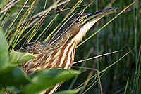 American Bittern, Common Moorhen, Greater Yellowlegs, Black-necked Stilt,American Avocet, Barn and Great Horned Owls, Tree Swallow, Western Meadowlark and Tricolored Blackbird. In late May I've seen lingering Lesser Scaup, Ross's and Snow Geese as well as the nesting Cinnamon Teal, Gadwall and Coots. Herons and egrets are regular any time of year. Summer breeders include Western Kingbird and Bullock's Oriole. American Pipit and Yellow-rumped Warblers abound fall until spring. From a late April field trip, Maggie Rufo also reported: Ash-throated
Flycatcher, EaredGgrebe, nesting Marsh Wren, White-faced Ibis, Yellow
Warbler and Yellow-billed Magpie. In addition she saw river otter and
muskrat. There's a visitors' center, toilets, boardwalk in the marsh, viewing platforms and signs to direct your drive through the Sacramento unit.
American Bittern, Common Moorhen, Greater Yellowlegs, Black-necked Stilt,American Avocet, Barn and Great Horned Owls, Tree Swallow, Western Meadowlark and Tricolored Blackbird. In late May I've seen lingering Lesser Scaup, Ross's and Snow Geese as well as the nesting Cinnamon Teal, Gadwall and Coots. Herons and egrets are regular any time of year. Summer breeders include Western Kingbird and Bullock's Oriole. American Pipit and Yellow-rumped Warblers abound fall until spring. From a late April field trip, Maggie Rufo also reported: Ash-throated
Flycatcher, EaredGgrebe, nesting Marsh Wren, White-faced Ibis, Yellow
Warbler and Yellow-billed Magpie. In addition she saw river otter and
muskrat. There's a visitors' center, toilets, boardwalk in the marsh, viewing platforms and signs to direct your drive through the Sacramento unit.
Arlene Gemmill's enthusiastic about this spot, "The Sacramento Wildlife Refuge also yields Eurasian Widgeon, Bald Eagle, Nuttall's Woodpecker, Sandhill Crane, White Fronted Goose and Tundra Swan in winter, often seen in fields surrounding preserve. People should check the skies and listen for their yodels; about 4 pm one hears the returning Geese and then sees thin skeins appearing from all directions as the Snow and Ross return to Refuge ponds - a not to be missed experience and worth an overnight stop just to catch."
Here's a bird checklist for ALL the refuge units:
http://www.npwrc.usgs.gov/resource/birds/chekbird/r1/sacramen.htm
For most recent wildfowl surveys:
http://www.fws.gov/sacramentovalleyrefuges/surveys.htm
For the next twenty miles north there will be rice paddies and some chance of waterbirds in or around them. Turkey Vultures, Crows and swallows in summer are common.
Willows, intersection of Cal 162, 153 miles [Glenn]
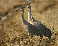 Exit here for Llano Seco, another part of Sacto Wildlife Refuge. Here you can see Sandhill Cranes in the winter. It is east of I-5 and you'll need good map of area to find it. Here's a description from the government website:
"Llano Seco Unit has two multi-level viewing platforms, interpretive kiosk, 2/3 mile walking trail, and restroom offer opportunities for wildlife observation, education/interpretation, and photography. Wildlife viewing is best from mid-November-January with good viewing of Sandhill cranes in fall. The primary habitat is seasonal wetlands and grasslands."
This section of road is best place in valley to look for Swainson's Hawk in breeding months as well, according to Dan Murphy.
Hambright Creek 162 miles [Glenn]
Just north of the town of Orland, a large gravel works north of this creek. Check the ponds for possible egrets, herons and waterbirds. Then you cross Stony Creek which also has gravel-covered floodplain.
Mt. Lassen becomes visible far to the right (east) 167 [Tehama]
There are roads heading into Mt. Lassen State Park both from Red Bluff and from Redding, further north on I-5. Mt. Lassen is the most recently active volcano in California, erupting less than a century ago.  Birds on the upper elevations include Townsend's Solitaire, Clark's Nutcracker, Evening Grosbeak, Mountain Chickadee, White-headed Woodpecker, Yellow-bellied and Red-breasted Sapsuckers, Dipper, Mountain Quail, Common Nighthawk, Blue Grouse and Goshawk. Golden Gate Audubon has an annual trip to Lassen each spring led by Dan Murphy. I recommend this trip. You also visit Burney Falls north of Lassen for its colony of Black Swift.
The roadside pastures from here north to the oak woodlands at Red Bluff provide habitat for Western Meadowlark, Western Kingbird, Turkey Vulture, Red-tailed Hawk, Crow, and Beechey's Ground Squirrel. Olive groves around Corning tend to have fewer birds visible from road.
Woodson Bridge exit 173 [Tehama]
Woodson Bridge State Recreation Area is a remnant of the riparian forests that once filled this valley. Nothing unusual here in way of birds, but if you are a fan of the Yellow-breasted Chat as I am, stop by in the spring for a listen and a look. The park is about six miles east of I-5 on South Avenue (County Rd. A9).
Of Woodson Dan Murphy says, "That's a great stop for riparian related species like Blue Grosbeak, Y-b Chat and other stuff of that ilk. It may be the last place in northern California where Yellow-billed Cuckoo nested -- no longer though. Nuttall's Woodpecker is probable as is Yellow-billed Magpie."
Corning Road, I-5 Exit 631 175 miles [Tehama]
Go east past the first intersection and go into Olive Pit if you want some of the local products. Nuts, olives, olive oil. Also has small cafe. Corning bills itself as "The Olive City." Only birds you'll likely encounter here: House Sparrows, Starlings and some very northern Northern Mockingbirds who colonized the upper Sacramento River Valley in the early 1900s.
Corning Rest Stop, 176 miles
Your chance to get close to olive groves. Don't expect many birds though Kingbird is possible.
Thomes Creek 178 miles
Large gravel works here. Turkey Vultures abound. Expect Cliff Swallows at every bridge in this section of I-5. Again, Kingbirds in areas where road is bounded by pasture or groves of trees.
Red Bluff northern city limits 196 miles [Tehama]
Here the habitat along the road is oak woodland with undergrowth largely of grasses that dry up in late spring.
Jellys Ferry Road 200 miles [Tehama]
For some riparian birding turn right and the road heads northeast. Before Jelly Ferry crosses the nearby Sacramento River, turn right onto Bend Ferry Road and go across the river to Bend Bridge Park. Here you will find the usual riparian species and a huge colony of Cliff Swallows under the bridge.
Back on Jellys Ferry continue north, at the bridge over the Sacramento look for the Osprey nest on the center span. Mountain Bluebirds and Lewis's Woodpeckers come down to this area to winter. This is also an area to expect Yellow-billed Magpie.
From the junction with Ben Ferry Road, you will drive 11.7 miles to Coleman Hatchery Road, turn right and go to Battle Creek Wildlife Area. Riparian species and a Bald Eagle nest near the fish hatchery at the end of this road. In the woods both Acorn and Nuttall's Woodpeckers.
To get back to I-5 you can retrace your drive, or continue north on Jelly Ferry, then left on Balls Ferry Road and follow the signs to I-5 near Anderson which is in Shasta County.
Anderson, Riverside exit 208 miles
Exit on Riverside and go east from I-5, pass a church on your left, then turn right at the stop light onto North Street. Then go south past a 7-11 store and turn left on Stingy Road. Take it several blocks to Rupert and turn left toward Anderson River Park. Once in the park you can find good riparian birding: Bullock's Oriole, Black-headed Grosbeak and Swallows in warm months, Oak Titmouse, California Quail and Nuttall's Woodpecker year round. The Bushtits have a dark mask not seen on their Bay Area cousins.
Redding southern city limits 220 miles [Shasta]
Here the first foothill (formerly "digger" after a pejorative name for the Native Americans who lived in the dry upper Sacramento River Valley) pines appear along the highway. They have long gray-green needles sparsely growing from branches that droop or sometimes form crazed curves. These are not the mast-straight pines you will see in higher and wetter woods.
Intersection with California Route 44. 223 miles
This highway goes west to the Pacific at Eureka, or east up the slope to Mount Lassen. Lassen National Volcanic Park reaches over 10,000 feet high at the volcano's summit. Most of the year it will carry a snowy covering near the top.
Intersection with California Route 299. 225 miles [Shasta]
Now you are gaining elevation and should begin to see snowy Mount Shasta up ahead, to the north. 299 goes east into the dry plateaus of eastern California and Alturas and westward through the Trinity Alps. You can exit here, and Will Wilson tells what to expect at a nearby birding spot,
"On SR 299 about 1.5 miles west of I-5 at Redding, taking the SR 299/SR44 exit, is Turtle Bay Exploration Park with an acre or two of parking and good views of the Sacramento River with easy-walking riparian habitat. In a 30 minute stop on a mid-May morning a few years ago saw nice array including Western Tanager, Bullock's Oriole, Oak Titmouse, Northern Rough-winged Swallows, Downy & Nuttall's Woodpeckers."
Town of Shasta Lake ele. 800, 228 miles [Shasta]
Intersection of Wonderland Blvd. 231 miles [Shasta]
You can exit to the east and then turn right to the visitors center for the Shasta-Trinity National Forests. There's a single picnic table, indoor rest rooms and a friendly staff. There's shady lawn and constant freeway noise. Good place to collect maps and folders on the region. Not many birds here but a man working there proudly tells me a Killdeer nested on their lawn in 2006. Expect House Sparrows, House Finch, Crows, Robins. The list for the National Forest itself includes: Common Nighthawk, California and Mountain Quail. Steller's and Scrub-jays, Mountain Chickadee, Dipper, Western Tanager, Anna's Hummingbird, Ruffed and Blue Grouse. Woodpeckers include Lewis's, Nuttall's, White-headed, Pileated, Black-backed, Hairy and Acorn. Sapsuckers: Yellow-bellied, Red-breasted and Williamson's are possible.
Enter snow zone 234 miles
Here the reflectors on the highway are sunken below the road surface so snowplows won't shear them off in the winter.
First bridge across arm of Shasta Lake 236 miles
Anywhere along this lake you can expect Osprey, Raven, Turkey Vultures and possible Bald Eagle.
Rest Area(s) 239 miles
For the northbound lanes it's called the O'Brien Rest Area. At the north end of the parking lot there's a small dog area and a drinking fountain. Stand behind this fountain and look north along the overhead electrical wires. Follow them until you see the first tall pylon, on the cross bar is a venerable Osprey nest. It should be in use April-July. In 2006 there were three young raised in this nest. At this rest area you may see Steller's Jays.
On the southbound side is the Lakehead Rest Area. It has superb dog walking area. An official wooden sign west of the parking area denotes "Poison Oak Area" in case you were in need of some, or just want to take a photo home to show the neighbors. No Osprey, few birds.
Distance to Portland,Oregon, 400 miles at 244 miles
Enter gorge of upper Sacramento River 257 miles [Shasta]
Keep watch for Osprey along the river.
Castle Crag views 267 miles [Shasta]
At this point you can look back along the Sacramento River and you should see large Osprey nest on the other side.
Castle Crag State Park exit 269 miles
In this area you can expect fly-overs from Raven, Turkey Vulture, Northern Flicker, Band-tailed Pigeon, Robin. Murphy has this to say about the stream at the foot of the Crag "Castle Crags -- birding is OK along the river in the morning with Wood-pewee, Olive-sided Flycatcher, Western Tanager, Wilson's, Orange-crowned and Yellow Warbler, Yellow-breasted Chat (bushwhacking on the west side of the river required), American Dipper, etc. Cassin's Vireo might be heard and seen in the picnic area and the campground (the small loop)."
Dunsmuir southern exit 275 mi [Siskiyou]
This town has more elevation than people. Fewer than 2,000 folks live here at 2,347 feet. Road is rising quickly.
Elevation 3,000 ft. 278 mi
Exit for McCloud to the east 281 miles [Siskiyou]
Go past town of McCloud on Highway 89 for some fine forest riverside birding. Here are the vireos, flycatchers and warblers associated with mid elevation forests: Macgillivray, Yellow and Hermit Warblers. Cassins' and Warbling Vireos. Flycatchers include Willow, Olive-sided, Hammond's, Dusky and Western Wood-pewee. Throw in Black-headed Grosbeak and Western Tanager, a Kingfisher or two and you can have a fine spring morning birding the campgrounds south of Highway 89 and east of McCloud just over five miles: Fowler, Middle Falls, the McCloud River Loop.
There is also decent birding south of Mount Shasta, reports Dan Murphy, "The road into Mt. Shasta City from the south may still have Lewis Woodpecker on phone poles and oaks. That's the first exit, not the Central Mt. Shasta Exit. The Central Mt. Shasta Exit is where you go to get to Mt. Shasta and find everything from low mountain birds to crossbills and unlikely but possible Rosy-finches."
Highways fly-overs here have included Raven and Band-tailed Pigeon.
Mount Shasta 284 miles [Siskiyou]
This is the highest mountain in northern California. A volcano that has not been active in ages, Shasta is always snow-topped, often creating its own clouds and weather out of the winds and the atmospheric moisture. It's over 14,100 feet above sea level at the summit. If you can take the road up the mountain as far as Burney Flat (6950 feet) you should see Mountain Bluebird, Black-capped Chickadee, Northern Flicker and Clark's Nutcracker around the parking lot. Check locally on driving conditions. Summer arrives late on Mt. Shasta.
Will Wilson says the lake west of the town of Mount Shasta can be worth a visit, "Lake Siskiyou sits about two miles west of Mt. Shasta City [Exit 738] and has a nice spring and summer assortment. Have seen Bald Eagle there in August. There are roadside-pullouts and day-use parking at Lake Siskiyou Camp-Resort. Early morning is best to avoid the hordes of late-sleeping campers. Stunning views of Mount Shasta."
Weed (that's a town not a thistle) 291 miles [Siskiyou]
Here you cross Highway 97 which goes northeast from here to the Klamath Falls area. But that's another birding trip altogether. Here you can find Bald Eagle in winter, Black Tern and Yellow Rail in summer. It's the home of dozens of wintering Bald Eagles.
Klamath Refuge link: www.fws.gov/klamathbasinrefuges/
Klamath Wildlife refuges map: www.fws.gov/klamathbasinrefuges/areamap.html
Leave Shasta National Forest 294 miles
Here you enter an area of recent lava flows, rock often visible on the surface or between the thin tufts of grass. In low spots are vernal pools. I've seen migrating Sandhill Cranes stopover here in the fall and spring. Some of the pools contain small dark birds--Coots? There are no good places to stop, no easy viewing. If you spot a gull, you're not crazy--Ring-billed nest in this area.
Shasta River 295 miles
Really just a large creek with a big name. But it flows through a volcanic plateau with heart-jumping views of Mount Shasta itself.
Weed rest Stop & Airport 298 miles [Siskiyou]
Ring-billed Gulls dominate out here. Have never seen a plane land or take off here. Watch for vernal ponds on both sides of the freeway. Turkey Vulture, Black-billed Magpie as this is adjunct to the Big Basin, Crow, Brewer's & Red-winged Blackbirds, Barn, Violet-green and Cliff Swallows. Also possible Beechey's Ground Squirrels on the fences and fence posts.
State of Jefferson & steel steer 312 miles
You've just left California and entered the rebel State of Jefferson. Big steel steer bawling in a field east of the road. On one trip there was a Bald Eagle sitting in a lone tree next to slough east of freeway about a quarter mile south of the steel steer.
Easy Street Exit 314 miles [Siskiyou]
For a good view of large farm pond exit here, go west over freeway and east (right) at the stop sign. You will quickly see large pond on your left. April-August there will be both Tricolored and Yellow-headed Blackbirds nesting here. Canada Geese, Mallards, Ruddy Ducks and Coots are year round. Myriad ducks in the winter. Swallows in the summer. Go east into Yreka to get back on freeway or retrace your route.
Yreka 318 miles.
Ring-billed Gulls sometimes swirl over the trash bins in central Yreka. Most head to the coast during coldest months.
Anderson Pass 326 miles [Siskiyou]
Elevation 3,000. You can see Pilot Rock straight ahead, just inside the Oregon border. It's over 5,000 feet high. Pioneers and trappers used this rock as a landmark long before there was a highway through the Siskiyou Mountains.
Klamath River Rest Stop 330 miles [Siskiyou]
This well-shaded rest stop is right next to the river though a fence keeps you from getting into the rapid flowing stream. The official name here is Randolph Collier Rest Area. This is a good birding. In July I've seen groups of Lewis's Woodpeckers in deciduous trees along both sides of the Klamath. Oaks cover the gorge slopes here. Lewis's Woodpeckers, Yellow Warbler (spring and summer), Ring-billed Gulls, Osprey, Bullock's Oriole (breeding season), Cliff Swallow, Crow, Brown-headed Cowbird, House Finch, Ravens, Western Kingbird.
Oregon Border 342 miles [Jackson County, Oregon]
North of the border you'll see the turn-off to Mount Ashland, tallest of the mountains in the Siskiyou range at over 7,500 feet. Mount Ashland looms just west of I-5 and may retain some snow until June. Great birding up there but that's another bird trip worth an entire morning from April until snowfall in the autumn. Western Tanager, Mountain Chickadee, Mountain Quail, White-headed Woodpecker, Dusky and other Flycatchers, Green-tailed Towhee, Macgillivray, Hermit and Yellow-rumped Warblers, Lazuli Bunting, Lincoln's Sparrow, Northern Flicker, Red-breasted Sapsucker, Mountain Bluebird, Hermit Thrush, Junco, Cassin's Finch. A spring or summer visit is worthwhile simply to hear the music of the Hermit Thrush coming out of the deep shade beneath the evergreens.
TOWHEE.NET: Harry Fuller, 820 NW 19th Street, McMinnville, OR 97128
website@towhee.net